Being an environmentalist by profession, Laxmi Goparaju has worked extensively with Forestry & Ecology Division (FED) of National Remote Sensing Centre (NRSC), Department of Space, India. She holds a doctorate in Environmental Science & Technology from Jawaharlal Nehru Technological University (JNTU), Hyderabad. The topic of her thesis, “Community Diversity Assessment in Vindhyans using Remote Sensing and GIS” formed a part of the Indian Space Research Organisation’s Geosphere Biosphere Programme (IGBP) that addressed issues related to global warming at regional and global level. (Click here for detailed profile.)
Summary
Developing nations today are facing a near crisis situation both economically and environmentally. Economics and Ecology are the two faces of the same coin since they have a common origin that is ‘oikos’ meaning housekeeping – economics meaning financial housekeeping and ecology meaning environmental housekeeping.
The growing concern about the negative effects of economic development necessitates conserving natural resources for sustainable development. It is high time that sustainability finds place in our development programmes.
In this aspect, Satellite Remote Sensing Data coupled with Geographic Information System (GIS) are providing efficient scientific methods to measure impact on environment, identify ‘safe’ habitats for wildlife, and monitor progress of various eco-friendly initiatives.
Goparaju Laxmi N., an Environment Professional, takes a look at this technology from an application perspective and explores how it can be deployed for different needs.
Introduction
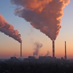
Industrialization and urbanization are responsible for the present day environment and climate change. Now, the issue is of global concern. Adequate measures have to be taken to protect the environment and natural resources. The consequences of industrialization can be summed up as follows:
- Changes in land use and land cover patterns
- Deforestation – resulting in loss of forest habitat and biodiversity
- Air and water pollution
- Watershed degradation causing increase of floods frequency
The role of environment management programmes is to have a proper inventory of the natural resources, planning for the optimal utilization and development of systems for conservation, and protection of resources.
Role of Satellite Remote Sensing and GIS
There has been progressive evolution of natural resource monitoring with the advent and evolution in the Indian Remote Sensing (IRS) series of satellites. Satellite images help to delineate accurately and map the physical features of the earth. Adequate information about land cover pattern, vegetation pattern, geology/geomorphology, hydrogeology, soil, drainage pattern, physiography of the study area is required to conduct studies regarding impact on environment. Satellite remote sensing provide accurate and synoptic spatial and temporal database featuring all the changes covering large and inaccessible areas in most time and cost effective ways. Satellite remote sensing data offers a better scope because of the availability of wide range of multi-spectral and multi-temporal data. Geographic Information System (GIS) is a software and hardware tool that helps in collection, storing, retrieving, transforming and displaying large spatial data, and in generating maps and modeling. Updating of maps is an easy task in GIS domain.
The applications of remote sensing and GIS in environment management programmes are as follows:
- Delineation of Soil and vegetation types
- Assessment of health and vigour of the crops and production of yield maps prior to harvest
- Mapping of the extent and severity of land cover degradation
- Assessment of the physical extent and turbidity of water bodies
- Site selection for industries and loss of agriculture/forest lands due to project activities
- Delineation of route alignment for power grids and pipe lines
- Ecological monitoring of thermal power plants
- Assessment of mining impacts
- Watershed characterization
- Minimizing the extensive and costly ground surveys


