4. In Watershed Development Programmes
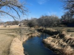
Watershed is defined as a natural hydrological unit, higher ground area from which the runoff (due to rainfall) flows to a specified drain, stream or river to a particular point. Watershed degradation has become a major environmental concern due to the conversion of forest area into pasture and agriculture. Hydrological processes are dynamic in nature and change frequently within seasons. Remote sensing and GIS play a major role in watershed modeling providing an integrated approach. Information about terrain, slope, aspect, flow direction, drainage pattern, soil erosion, can be derived in GIS domain when subjected to terrain analysis (Digital Elevation Model – DEM). Besides this, GIS handles distributed excess rainfall in calculating local surface runoff rates as inputs for channel flow. Aerial photographs, LANDSAT – TM data and LISS III data have been successfully utilized in such studies. RADAR has opened new opportunities in this area due to its active sensing
capabilities, allowing the time window of image acquisition to include inclement weather conditions or seasonal or diurnal darkness.
Watershed development and management practice will help in sustainable development of water resources; thus, utilizing rain water for harvesting of crops, prevent soil erosion, enhance soil fertility, recharge ground water and reducing the run off.
Watershed modeling studies have been carried out for Kundapallam Watershed of Nilgiri District, Tamil Nadu using remote sensing and GIS. The study has come up with environmental sensitivity map. (Refer: http://www.gisdevelopment.net)
References
- Roy, P.S., and Joshi, P.K., 2000 Space remote sensing for sustainable forest management.,pp357-382, In: R.K. Kholi, H.P. Singh, S.P. Vij, K.K. Dhir, D.R. Bhatish and D.K. Khurana(eds.) Man and Forest. DNAES, IUFRO, ISTS, Panjab University, Chandhigarh.
- Balaguru, B., S. John Britto, N. Nagamurugan, D. Natarajan, S. Soosairaj, S. Ravipaul and D. I. Arockiasamy, “Vegetation Mapping and Slope Characteristics in Shervaryan Hills, Eastern Ghats Using Remote Sensing and GIS”, (645-653), Current Science, 85(5), 2003.
- Thenkabail, P., Enclonab, E., Ashtonb, M., Legg, C., De Dieu, M., “Hyperion, IKONOS, ALI, and ETM+ Sensors in the Study of African Rainforests”, (23–43), Remote Sensing of Environment, 90, 2004.
- Goparaju, L. and Jha, C.S. 2010. Spatial Dynamics of Species Diversity in Fragmented Plant Communities of Vindhyan Dry Tropical Forest in India. Tropical Ecology 51 (1):55-65.
- Jha, C.S., Goparaju, L., and Pujar, G.S., 2002. Proceedings of ‘Impact of land use and land cover changes around a Super thermal power plant-an assessment using remote sensing and GIS’. During the LUCC-ISPRS workshop on LUCC contribution to Asian environmental problems held on 2nd December 2002 at Hyderabad.
Abbreviations
DEM – Digital Elevation Model
DGPS – Differential Global Positioning System
GIS – Geographical Information Systems
GPS – Global Positioning System
IRS – Indian Remote Sensing Satellite
ISRO – Indian Space Research Institute
IKONOS – name of satellite launched in September 1999
LANDSAT _ TM – Landsat Thematic Mapper
LIDAR – Light Detecting and Ranging
LISS – Linear Imaging Self Scanner
MOS – Marine Observation Satellite
NRSC – National Remote Sensing Centre
PAN – Panchromatic
RADAR – Radio Detection and Ranging
SPOT – Satellites d’observation de la Terre
WiFS – Wide Field Sensor


