National Science Foundation, USA: Irrigation for agriculture is the largest use of fresh water around the globe, but precise records and maps of when and where water is applied by farmers are difficult to locate. Now a team of researchers has discovered how to track water used in agriculture.
In a paper published in the journal Geophysical Research Letters, the researchers detail their use of satellite images to produce annual maps of irrigation. The findings, the scientists said, will help farmers, water resource managers and others understand agricultural irrigation choices and make better water management decisions.
“We want to know how human activities are having an impact on the environment,” said hydrogeologist David Hyndman of Michigan State University (MSU), principal investigator of the project. “Irrigation nearly doubles crop yields and increases farmer incomes, but unsustainable water use for irrigation is resulting in depletion of groundwater aquifers around the world. The question is: ‘How can we best use water?”
The paper highlights the need to know when and where irrigation is occurring to effectively manage water resources.
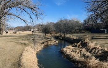
The project focuses on an economically important agricultural region of the central U.S.–the Republican River Basin–that overlies portions of Colorado, Nebraska and Kansas, and provides surface water and groundwater to the High Plains Aquifer. The team found that irrigation in this area roughly doubled between 2002 and 2016.
Water use in this region can be complicated because it is regulated to preserve stream flow into Kansas in accordance with the Republican River Compact of 1942.
“Previously, we knew what farms were equipped to irrigate, but not which fields were actually irrigated in any particular year,” said Jillian Deines, also of MSU and the paper’s lead author. “Our irrigation maps provide this information over 18 years and can be used to understand the factors that contribute to irrigation decisions.”
The researchers used Google Earth Engine, a cloud-computing platform that makes large-scale satellite and environmental data analyses available to the public, to quantify changes in irrigation from year to year–an important finding for farmers, crop consultants and policymakers working to improve the efficiency of irrigation.
Google Earth Engine has been an asset for computing the large number of satellite images needed, the scientists said. “It allows researchers to use consistent methods to examine large regions through time,” Deines said.

The project, which also involves MSU research associate Anthony Kendall, is supported by the joint National Science Foundation (NSF)-USDA National Institute of Food and Agriculture (NIFA) Water, Sustainability and Climate (WSC) program and the joint NSF-NIFA Innovations at the Nexus of Food, Energy and Water Systems (INFEWS) program.
“Knowing what to plant, how much land to plant, and how much irrigation water is necessary to support a crop through harvest has been a challenge for farmers throughout time,” said Tom Torgersen, NSF program officer for WSC and INFEWS. “Farmers can now envision a future where models will provide options to help guide decisions for greater efficiency and crop productivity.”
Program managers at USDA-NIFA said that demand for agricultural products will likely increase in the future, while water for irrigation may decrease due to water quality issues and competitive uses.
The Republican River Basin researchers “leveraged new computing power to handle the ‘Big Data’ of all available Landsat satellite scenes, and developed irrigation maps that help explain human decisions about irrigation water use,” said Jim Dobrowolski, program officer in NIFA’s Division of Environmental Systems. The maps hold the promise, he said, of the ability to make future water use predictions.


