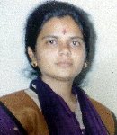
Laxmi N. Goparaju holds a doctorate degree in Environmental Science & Technology from Jawaharlal Nehru Technological University (JNTU), Hyderabad, India. Her Masters’ Degree is in Botany with specialization in Taxonomy from University of Allahabad, Allahabad, India.
An environmentalist by profession, she has extensively worked with Forestry & Ecology Division (FED) at National Remote Sensing Centre (NRSC), Department of Space, India, during 1999-2003 on various projects involving multi-temporal and multi-resolution satellite data and related ancillary data in Remote Sensing and GIS applications. She has been trained in use of various techniques of image processing and also in field inventory for vegetation data collection and Differential Geographic Positioning System operation.
The topic of her thesis, “Community Diversity Assessment in Vindhyans using Remote Sensing and GIS” formed a part of the Indian Space Research Organisation’s Geosphere Biosphere Programme (IGBP) that addressed issues related to global warming at regional and global level.
She has worked on Environment Impact Assessment of Super Thermal Power Plants in the Korba, Madhya Pradesh and Farakka, West Bengal, India and has also been associated with Tiger habitat suitability assessment using remote sensing and GIS in the state of Madhya Pradesh, India, and has also been a member in the Indo-German Changar eco-development project at Himachal Pradesh, India.
She writes for ThinktoSustain on topical issues related to ecology, global warming and climate change, and can be reached at laxmi@thinktosustain.com
Publications
- Goparaju,L. and Jha,C.S., 2010. ‘Spatial Dynamics of Species Diversity in Fragmented Plant Communities of a Vindhyan Dry Tropical Forest in India’. Tropical Ecology 51(1):55-65.
- Goparaju,L., Tripathi,A., and Jha,C.S., 2005. ‘Forest Fragmentation Impacts on Phytodiversity – An Analysis using Remote Sensing & GIS’. Current Science, Vol.88; no.8; 1264-1274.
- Jha,C.S., Goparaju,L., Tripathi,A., Gharai,B., Raghubanshi,A.S. and Singh,J.S., 2005. Forest Fragmentation and its Impact on Species Diversity – An Analysis using Remote Sensing & GIS’. Biodiversity and Conservation, 14; 1681-1698.
- Goparaju,L., Gharai,B. and Jha,C.S., 2003. ‘Plant Community Diversity Assessment in Vindhyan Highlands using Remote Sensing & GIS’ (L-42). In: International Training Course in Geoinformatics for Biodiversity Assessment (18 August-12 September, 2003), organized by Centre for Space Science & Technology Education in Asia and the Pacific (CSSTLAP) affiliated to UN, IIRS, Dehradun, September 2003.
- Goparaju,L., Jha,C.S. and Ravi Kumar,A., 2003. ‘Future of Biodiversity in View of Remote Sensing’. Pp 17-25. In: Proceedings of Inter-centre Technical Seminar in Hindi, 19 September 2003. NRSA and ADRIN, Hyderabad.
- Jha,C.S., Goparaju,L., and Dutt,C.B.S., 2001. ‘Biodiversity in Vindhyans – A Study’. Pp 306-313. In: Proceedings of Inter-centre Technical Seminar in Hindi, 13th September 2001. ISTRAC, Bangalore.
- Jha,C.S., Singh,J.S., Raghubanshi,A.S., Dutt,C.B.S., Goparaju,L., and Tripathi,A., 2000. ‘Community Diversity Assessment in Vindhyans Using Remote Sensing & GIS’. Pp 99-102. In: Book of Abstracts, Chairman’s Review of ISRO-GBP Projects and the third Workshop on Scientific Results from ISRO Geosphere Biosphere Programme.
Presentations
- Presented paper Goparaju,L., Jha,C.S., and Dutt,C.B.S. 2003. ‘Multi-season Classification of Plant Communities of Vindhyan Highlands’. During 90th session of Indian Science Congress held at Bangalore between 3-7 January 2003.
- Presented paper Goparaju,L., Tripathi,A., Jha,C.S., Raghubanshi,A.S., Singh,J.S. and Dutt,C.B.S. 2002. ‘Temporal Vegetation Analysis in Vindhyans using Remote Sensing & GIS’. During 3-7 January 2002 in Botany section at 89th Indian Science Congress held at Lucknow.
- Presented paper Jha,C.S., Goparaju,L., and Pujar,G.S., 2002. ‘Impact of Land Use and Land Cover Changes Around a Super Thermal Power Plant – An Assessment using Remote Sensing & GIS’. During the LUCC-ISPRS Workshop on LUCC Contribution to Asian Environmental Problems held on 2 December 2002 at Hyderabad.
- Presented paper Goparaju,L., Jha,C.S., Tripathi,A., Raghubanshi,A.S., Singh,J.S., and Dutt,C.B.S. 2002. ‘Diversity Analysis in Vegetation Change Area of Vindhyan Highlands using Remote Sensing & GIS’. During International Symposium on ‘Resource and Environmental Monitoring’; held during 3-6 December 2002 at Hyderabad.
Reports
- Submitted project report, “Community Diversity Assessment in Vindhyans using Remote Sensing & GIS,” ISRO Geosphere Biosphere Programme (SWG LULC & ED) NRSA/FED-TR 2003.
- Project titled, ‘Flora of Allahabad – Family Solanacea,’ (1998) as project work in Taxonomy (specialization paper) in M.Sc. (Botany).


