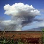
Let us see some satellite sensor characteristics which are the basis for various forest studies using the specified remote sensing data. Table 1 shows the details of some high resolution sensors. Figure 2 shows the use of satellite remote sensing data and GIS in addressing various issues related to forest degradation. Table 2 explains the advantage of using remote sensing data in survey as compared to traditional surveying methods.


Related Stories on ThinktoSustain.com
 Jul 17, 2010UNEP Report on Latin America and the Caribbean Addresses Environmental Degradation
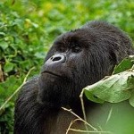 Dec 17, 2010Increase in Population of Critically Endangered Mountain Gorillas Confirmed
 Mar 21, 2014Ending Hunger, Undernutrition Must Be Top Priority in Post-2015 Development Agenda
 Sep 15, 2011Joint Study by SAP and Univ of St Gallen Reveals Rise of Sustainability in Retail
 Apr 19, 2010Urban ‘Green’ Spaces may contribute to Global Warming
 Apr 12, 2014New Approach for Efficient, Inclusive, Sustainable Urbanization in China
 Jul 22, 2011Citizenship and Sustainability Goals Launched by Johnson & Johnson
- Dec 11, 2012NextEra Energy Releases 2012 Corporate Responsibility Report


