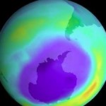
Both satellite observations and coordinated launches of ozonesondes carried by weather balloons show us at which altitudes the ozone loss takes place. These measurements show that the ozone loss takes place between 15 and 23 km above the ground with an ozone minimum around 19-20 km. This coincides with the region of low temperatures below -78°C. In this region, more than 2/3 of the ozone has been destroyed so far. Measurements from the SCIAMACHY satellite instrument show record high amounts of the molecule OClO, a compound that takes part in ozone destruction. Satellite measurements of total ozone from OMI, GOME-2 and SCIAMACHY show a region of low ozone above the Arctic regions. As of late March, the ozone poor region is shifted away from the pole and covers Greenland and Scandinavia.
The Vienna Convention to Protect the Ozone Layer came into force in 1985. Two years later, the Montreal Protocol to phase out production and consumption of ozone-depleting products was signed. The Montreal Protocol has been reinforced on several occasions after 1987.
Images of total ozone column and vertical ozone profiles around the pole on March 30, developed by Finnish Meteorological Institute using satellite and ground based data, can be found at:
http://www.ava.fmi.fi/~jtammine/gomos_video.gif
The 2010 WMO/UNEP Scientific Assessment on Ozone Depletion with more details about the current state of the ozone layer and projections for the future is available at:
http://www.esrl.noaa.gov/csd/assessments/ozone/
Source: WMO Press Release dated April 5, 2011.


